Upper Multnomah Falls
0
- Gilbert K. Chesterton.
| facebook | 500px | ferpectshots |
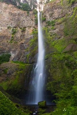
Multnomah Falls is the tallest waterfall in Oregon at 620ft and has an often-disputed claim as the 2nd tallest year-round waterfall in the United States. I am not sure about the height of the falls, but it is, without a doubt, one of the most recognized waterfalls. Even the folks who haven’t heard about the falls instantly recognize the shape, two-tiered structure, and the viewing bridge across the falls. I was somewhat surprised by the tiny viewing area for such a famous waterfall and soon realized that the available compositions are limited.
After taking the customary shot at the base of the falls, we hiked up to the viewing bridge, and I managed to make an image that I have not seen before. This composition is of the upper part of the Multnomah Falls from the viewing bridge. I like this composition a lot and felt this was a fresh look at this majestic waterfall without the elements that make it familiar.
0
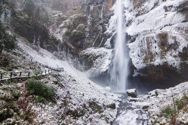
Multnomah Falls, Columbia Gorge, Oregon
It was incredible going up to the bridge above the lower falls and seeing all the ice in the bowl of the...
0
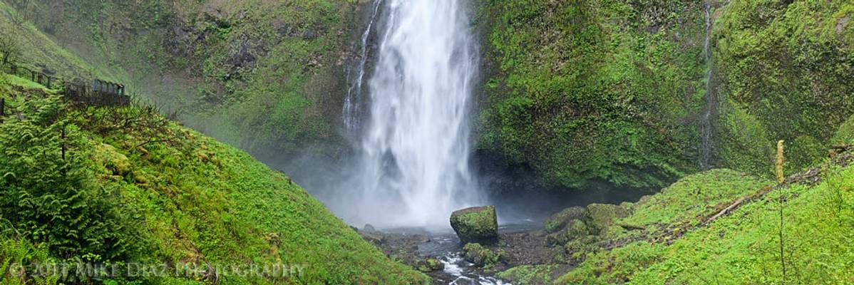
This is a four shot stitch taken from the footbridge that spans Multnomah Falls, cropped to a 3:1 ratio. We got here nice and early so we could...